Extreme High Tides Could Flood Our City's Streets
Sunday, October 12, 2014
Play
00:00 / 00:00
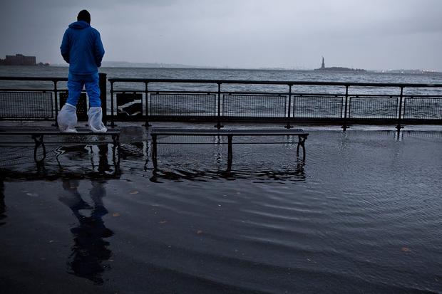
 Water from the Hudson River breaching the sea wall in Lower Manhattan during Sandy. (TIMOTHY A. CLARY/Getty)
 Columbia University geophysicist Klaus Jacob likes to say that we built this city all wrong, by putting the living down near the shore and the dead in cemeteries on our hills.
That spells trouble for the future, because the Atlantic is expected to rise about a foot and a half by 2050.
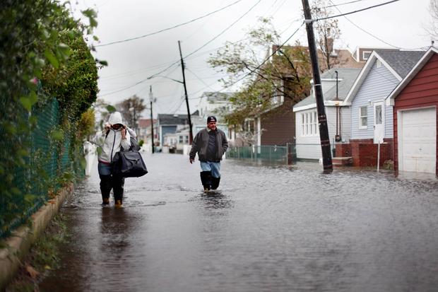
What we now call a hundred-year-storm will spin toward us once every 20 years. The new hundred-year storm will affect more than 800,000 New Yorkers, almost twice as many people as one would today. Eight percent of the city's shorelines — areas such as Howard Beach, Broad Channel and College Point — could see seawater creeping up onto streets as often as twice a day, during high tides.
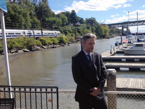
 In Tarrytown, Metro-North commuter trains are already running pretty close to the water. Tobey Ritz, chief engineer of capital projects for Metro-North, said the people who started the railroad nearly 200 years ago, wanted to follow the Hudson River and at the time no one knew the water was rising. Assuming the sea level rises by 1.5 feet by 2050, the track will be about 4.5 feet above normal high tides. Even a mild hurricane or Nor'easter could drown the tracks. But moving 30, maybe 60, miles of track higher by a few feet would be outrageously expensive, Ritz said.
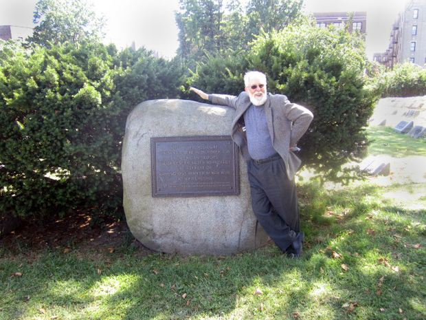
 Unlike New Orleans, New York City has elevation: places that are tens, even hundreds of feet above sea level and are safe from storm surge, even if the sea level rises by a few feet. Oddly enough some of that space is occupied by cemeteries: Greenwood and Cypress Hills, two of the city's largest burying areas, were built on the terminal moraine, a ridge left by glaciers thousands of years ago that runs across Brooklyn and Queens. “We put our ancestors when they die at the highest points in New York City and we live in the most risky places in the lowlands right on the waterfront,” Jacob, the Columbia scientist, says.
 New York has plenty of other neighborhoods on high ground as well, but Jacob says people are actually moving away from them and towards waterfront areas instead.
 Last fall, the City Council passed a law requiring all new homes to be built two feet above the hundred-year-flood stage (based on a 1 percent chance a flood will occur in any given year), known as two feet of freeboard. But if sea level rises faster than expected, or a particularly bad storm hits, even these buildings could get flooded in the 2050s. The city is exploring ways to make sure the most critical elements of a building are even higher. The city is also developing plans with the U.S. Army Corps of Engineers to build a series of sea walls and levees along the coast.
That spells trouble for the future, because the Atlantic is expected to rise about a foot and a half by 2050.
What we now call a hundred-year-storm will spin toward us once every 20 years. The new hundred-year storm will affect more than 800,000 New Yorkers, almost twice as many people as one would today. Eight percent of the city's shorelines — areas such as Howard Beach, Broad Channel and College Point — could see seawater creeping up onto streets as often as twice a day, during high tides.
The Problem
The sea level is expected to rise between 11 and 21 inches than the 2000 level by 2050, according to the middle range of projections by the New York City Panel on Climate Change. If on the high end of that range, an estimated 43 miles of the city's shoreline could see daily or weekly flooding due to rising seal levels, unless walls or levees are constructed.Possible Solutions
Because there's a snowball effect, if the Metro North raised some of its tracks above the Hudson River, a lot of the surrounding infrastructure such as stations, parking and local roads will also have to be raised. The railroad is making sure, however, that electrical cables are high off the ground, so salt water doesn't corrode the connections the way it did during Sandy. Officials say they plan to put snow-melter cabinets, signal bungalows and substations in containers on stilts.More in:
-

Matthew Schuerman, Editor, WNYC
Matthew Schuerman joined WNYC in December 2007 as the transportation and economic development reporter. He covered repeated financial crises at the MTA, the most severe transit cuts in decades, as well as the impact of the recession on the Atlantic Yards project in Brooklyn and the World Trade Center redevelopment in Lower Manhattan. Since 2010, Schuerman has been an editor in the WNYC newsroom. In addition, he has recently reported a number of Sandy-related stories.


0 comments:
Post a Comment